By Robert C. Jones Jr.
University of Miami
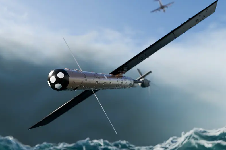
At some point during this Atlantic hurricane season, if a storm develops in or enters the Gulf of Mexico, crewmembers aboard a WC-130J Weatherbird aircraft will drop an array of torpedo-shaped sensors into the waters below, monitoring the instruments as they record data on temperature, salinity, current, and pressure while descending to depths more than a mile deep.
Such readings will be critical. Transmitted in real time to the National Hurricane Center in Miami, they will help forecasters project the storm’s likely path, which will allow emergency managers to issue advisories and warnings to protect assets.
For University of Miami ocean scientist Lynn “Nick” Shay, the measurements will prove just as indispensable. He will employ the data to help answer challenging questions about the process and timing of rapid intensification, when a hurricane’s maximum sustained winds increase by at least 35 miles per hour in 24 hours.
Factors such as warm water, high atmospheric moisture, and low wind shear are known to play significant roles in that process. But determining precisely how the inner core of a storm changes so abruptly, and forecasting when and where a storm will explode, still present daunting challenges for researchers, even after decades of investigation.
Learning more about warm water eddies that break off from the Loop Current in the Gulf could help forecasters overcome those challenges.
“They can supercharge storms,” Shay, a professor in the Department of Ocean Sciences at the Rosenstiel School of Marine, Atmospheric, and Earth Science, said of eddies, noting that they can act like high-octane fuel that energizes storms that pass over them.
Should a storm churn in the Gulf this season, the ElectroMagnetic Autonomous Profiling Explorer, or EM-APEX, floats that Shay and his team will deploy from Hurricane Hunter aircraft out of the 53rd Weather Reconnaissance Squadron at Keesler Air Force Base in Biloxi, Mississippi, will help unlock the key air-sea interaction processes involved in rapid intensification.
“The beauty of these floats is that they enable us to sample quickly in the upper layers of the ocean and then, as time evolves, go deeper and deeper. And when they surface, they send all the data back through satellite remote sensing,” Shay said. “We’re always cognizant about storms in the Gulf. Ideally, what we’ll need is a well-defined storm track before we deploy any instruments.”
The readings will be complemented by other oceanic and atmospheric instruments deployed from the Weatherbird aircraft.
Shay’s sensor deployments will be among many research endeavors University of Miami investigators will undertake this season as part of ongoing efforts to learn more about hurricanes—from their structure and strength to how the winds and waves they generate affect coastal structures.
The National Oceanic and Atmospheric Administration (NOAA)’s Hurricane Hunter aircraft, on which a team of University researchers regularly deploys, will again soar into the heart of storms, collecting data that will not only improve forecasts but also lead to a better understanding of storm dynamics.
Last year, the Hurricane Hunters—two Lockheed P-3 Orion turboprop craft nicknamed Kermit and Miss Piggy and a Gulfstream IV jet, all based out of Lakeland, Florida—flew 55 missions into hurricanes and tropical storms, logging some 387 hours of flight time and covering more than 130,000 miles, the equivalent of flying around the world more than five times.
This year, despite NOAA forecasters predicting a below-average Atlantic hurricane season, scientists who deploy on the high-flying meteorological stations as part of NOAA’s Hurricane Field Program still hope to continue testing promising new storm-forecasting instruments ranging from high-tech drones to wave drifters, according to Jason Dunion, a meteorologist at the Rosenstiel School-based Cooperative Institute for Marine and Atmospheric Studies (CIMAS) and with NOAA’s Hurricane Research Division.
Launched from the belly of Kermit and Miss Piggy, Black Swift S0 drones will measure pressure, temperature, humidity, and wind speeds inside a hurricane while flying as low as 200 meters above the surface of the ocean—an altitude unsafe for the P-3s.
A Black Swift drone is deployed from the underbelly of a NOAA Hurricane Hunter. Photo credit: Black Swift Technologies.
A total of 18 of the 20-pound drones, which can survive inside a storm for up to two hours, were deployed last season. Researchers hope to deploy several more this year, according to Dunion.
“Toward the end of their flights, the drones measure the critically important hurricane boundary layer where energy from the ocean is being transferred up into the hurricane,” said Dunion, who will serve as lead project scientist on P-3 flights this season and assist in coordinating ground-support efforts.
This season, hurricane data collected by the drones will be seamlessly incorporated into NOAA’s flagship hurricane forecast model, the Hurricane Analysis and Forecast System, or HAFS, in near real time.
Researchers will continue to test a storm observation instrument called a StreamSonde. Released from the bottom of the P-3 aircraft, StreamSondes weigh just a few grams and descend at speeds of only 5 meters per second without a parachute, extending the data collection window for researchers to gather atmospheric measurements from flight level to the ocean surface. “We’ll release them in swarms this season to provide detailed measurements of key areas in the hurricane environment,” Dunion said.
Drifters that measure wave height and sea surface temperature before, during, and after a hurricane; an Airborne Doppler Lidar that uses laser technology to continuously measure winds, aerosols, and precipitation below the aircraft; and a scanning radar system that operates at microwave frequencies onboard the P-3s and provides 3D profiles of precipitation and winds as well as measurements of wave heights are among the other high-tech instruments researchers will employ this season.
CIMAS associate scientist Andy Hazelton will be part of the leadership team at the Hurricane Field Program that will test the new technology. “The goal,” he said, “is always to improve data collection and, ultimately, forecasts.”
He will also help in the continued testing, evaluating, and upgrading of HAFS, NOAA’s newest numerical model and data assimilation system that provides more reliable and skillful guidance on tropical cyclone track, intensity, and structure, and can extend forecasting out to seven days.
“One thing we’re continuing to work on this year is a multi-storm version of HAFS in which we put multiple high-resolution nests inside a single domain to better capture the storm-storm interactions,” Hazelton said. Acting like a digital magnifying glass, nests are high-resolution, storm-following grids embedded within the HAFS’ broader, lower-resolution domain, allowing forecasters to zoom in on a hurricane’s inner core without having to apply high resolution globally.
“This is a continuation of an effort we’ve been working on for a few years now, and we hope to eventually transition this version to operations,” Hazelton explained. “For this year, we’ll be working on doing near real-time runs with the support of the Hurricane Forecast Improvement Program. We’ll be doing one basin-scale domain over the Atlantic and one over the East and Central Pacific, since we anticipate a busy Pacific season with El Niño developing.”
Not all of the investigators involved in hurricane research this season will fly aboard Hurricane Hunters. Some, like College of Engineering researcher Landolf Rhode-Barbarigos, will conduct high-tech simulations indoors to learn what they need to know about storms.
An associate professor of civil and architectural engineering, Rhode-Barbarigos and professor of ocean sciences Brian Haus are using the Rosenstiel School’s 75-foot-long SUSTAIN (SUrge-STructure-Atmosphere INteraction) hurricane simulator to find out how powerful wind and storm surge conditions generated by cyclones impact coastal structures.
As part of their study, which is funded by the National Institute of Standards and Technology, the two researchers place a miniature replica of a home on stilts inside the 75-foot-long tank, subjecting the model to conditions ranging from tropical storm force winds to a Category 3 hurricane. Sensors embedded within the plexiglass structure allow the researchers to take three types of measurements: readings that show the impact wave heights, wind velocity, and a combination of the two.
“And SUSTAIN is unique in that aspect,” Rhode-Barbarigos, who is also associate director of the University’s Climate Resilience Institute, said of the tank, which can recreate conditions all the way up to a Category 5 hurricane. “We can simulate conditions of waves only, winds only, and the two combined.”
“It’s not only important to improve storm forecasting but also to learn as much as we can about the impacts of storms and solutions to those impacts,” Rhode-Barbarigos said. “We’ll be able to scale up the results of our study and apply them to real-world structures to see how wind and wave loads affect designs. This translates not only to existing buildings but also new construction. It’s a big step toward better standards and codes.”


This Post Has One Comment
Đây là cộng đồng game khá vui vẻ 188v bet TONY06-29